Sunday, April 26, 2009

Eiffel Tower Travel Gallery


Eiffel Tower Travel Gallery
The structure was built between 1887 and 1889 as the entrance arch for the Exposition Universelle, a World's Fair marking the centennial celebration of the French Revolution. Eiffel originally planned to build the tower in Barcelona, for the Universal Exposition of 1888, but those responsible at the Barcelona city hall thought it was a strange and expensive construction, which did not fit into the design of the city. After the refusal of the Consistory of Barcelona, Eiffel submitted his draft to those responsible for the Universal Exhibition in Paris, where he would build his tower a year later, in 1889. The tower was inaugurated on 31 March 1889, and opened on 6 May. Three hundred workers joined together 18,038 pieces of puddled iron (a very pure form of structural iron), using two and a half million rivets, in a structural design by Maurice Koechlin. The risk of accident was great, for unlike modern skyscrapers the tower is an open frame without any intermediate floors except the two platforms. However, because Eiffel took safety precautions, including the use of movable stagings, guard-rails and screens, only one man died.The tower was met with much criticism from the public when it was built, with many calling it an eyesore. Newspapers of the day were filled with angry letters from the arts community of Paris. One is quoted extensively in William Watson's US Government Printing Office publication of 1892 Paris Universal Exposition: Civil Engineering, Public Works, and Architecture. “And during twenty years we shall see, stretching over the entire city, still thrilling with the genius of so many centuries, we shall see stretching out like a black blot the odious shadow of the odious column built up of riveted iron plates.” Signers of this letter included Jean-Louis-Ernest Meissonier, Charles Gounod, Charles Garnier, Jean-Léon Gérôme, William-Adolphe Bouguereau, and Alexandre Dumas.
Novelist Guy de Maupassant who claimed to hate the tower supposedly ate lunch in the Tower's restaurant every day. When asked why, he answered that it was the one place in Paris where one could not see the structure. Today, the Tower is widely considered to be a striking piece of structural art.

One of the great Hollywood movie clichés is that the view from a Parisian window always includes the tower. In reality, since zoning restrictions limit the height of most buildings in Paris to 7 stories, only a very few of the taller buildings have a clear view of the tower.

Eiffel had a permit for the tower to stand for 20 years, meaning it would have had to be dismantled in 1909, when its ownership would revert to the City of Paris. The City had planned to tear it down (part of the original contest rules for designing a tower was that it could be easily demolished) but as the tower proved valuable for communication purposes, it was allowed to remain after the expiration of the permit. The military used it to dispatch Parisian taxis to the front line during the First Battle of the Marne, and it therefore became a victory statue of that battle.
By: Wikipedia.com

Sunday, April 19, 2009

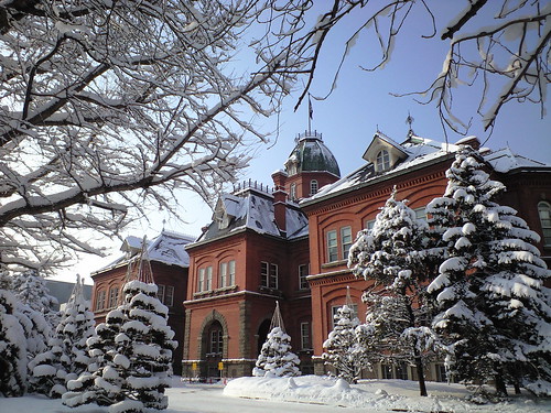
Former Hokkaidō government office building


Former Hokkaidō government office building
The Former Hokkaidō Government Office Building (,Hokkaidōchō kyūhonchōsha) is an American-neo-baroque structure constructed in 1888 as a base of the Hokkaidō administration. The nickname is Akarenga or "Red Brick." It is the symbol of Hokkaidō and was designated a Japanese Important Cultural Properties in 1969. Behind the current Hokkaidō Government building, the building is located in North 3 West 6, Chūō-ku, Sapporo, Hokkaidō, Japan.

Currently, the facilities inside the building include a conference room, a museum shop, a tourist information office, and a few historical exhibition rooms and libraries. Visitors can enter the building for free. Flower gardens and a pond are located in front of the building, which occasionally are designated as some event venues.
By : Wikipedia.com

Saturday, April 18, 2009

Sapporo in Japan Travel Gallery


Sapporo in Japan Travel Gallery
Sapporo (Sapporo-shi) ja-Sapporo.ogg listen (help·info) is the fifth-largest city in Japan by population. It is the capital of Hokkaidō Prefecture, located in Ishikari Subprefecture, and an ordinance-designated city of Japan.
Sapporo is best known outside Japan for hosting the 1972 Winter Olympics, the first ever held in Asia and the annual Yuki Matsuri in the city, internationally referred to as the Sapporo Snow Festival, which draws more than 2 million tourists from around the world. The city is also home to the eponymous Sapporo Brewery.
By : Wikipedia.com

Monday, April 13, 2009

North Beach Deluxe Food Lover's


North Beach Deluxe Food Lover's
Have you ever imagined taking an exotic trip to the South Pacific? There is a special place where you can be the first to experience sunrise on the planet each day. It's an ancient archipelago with over three hundred tropical islands. Cannibals once inhabited these parts and colonial mariners once sailed through them at their own peril. But it's a whole different ballgame now. Bula! Welcome to the Fiji Islands!

Thursday, April 9, 2009

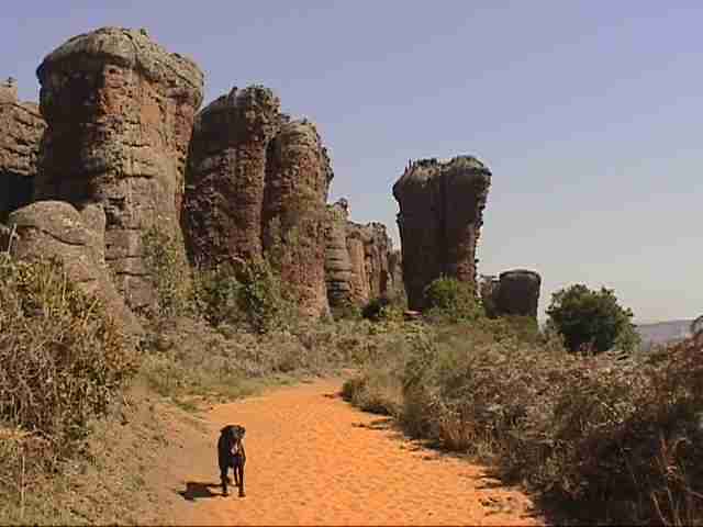
Vitória state of Espírito Santo, Brazil.


Vitória state of Espírito Santo, Brazil.
Vitória ( in English "Victory") is the capital of the state of Espírito Santo, Brazil. It is located on a small island within a bay where a few rivers meet the sea. It was founded in 1551. The city proper (area 93 km2 or 35.9 sq mi) has a population of 313,300 (2005) whilst the Greater Vitória metropolitan area has a population of over 1,612,885 (2005), the 14th largest in Brazil. In 1998, the United Nations rated Vitória as the fourth best state capital in Brazil to live in, rating cities on health, education, and social improvement projects.
The new Eurico de Aguiar Salles Airport connects Vitória with many Brazilian cities.
The city is home to the Federal University of Espírito Santo (UFES).
By : Wikipedia.com
Wednesday, April 8, 2009

Vila Velha is a coastal town in Espírito Santo


Vila Velha is a coastal town in Espírito Santo
Vila Velha is a coastal town in Espírito Santo, Brazil. It lies across from Vitória, the state capital. Its population was 396,323 (2005) and its area is 208.82 km².
Vila Velha forms part of the Greater Vitória metropolitan area. To the north is Vitória, to the west Cariacica and Viana, to the south Guarapari, and to the east the Atlantic Ocean.

Notable corporations in Vila Velha include Garoto, one of Brazil's largest chocolate manufacturers.
Vila Velha used to have one of the best coastal areas of Espírito Santo. Unfortunatelly, due to intense real estate development, its mains beaches, like Praia da Costa, Itapuã and Itaparica were virtually destroyed by a wall of high buildings. That massive skyline casts a shadow on those beaches during the afternoon hours.
By : Wikipedia.com

Cinque Terre In Italy


Cinque Terre In Italy
The Cinque Terre (pronounced CHEEN-kweh TEHR-reh) is a rugged portion of coast on the Italian Riviera. It is in the Liguria region of Italy, to the west of the city of La Spezia. "The Five Lands" comprises five villages: Monterosso al Mare, Vernazza, Corniglia, Manarola, and Riomaggiore.

The coastline, the five villages, and the surrounding hillsides are all part of the Cinque Terre National Park and is a UNESCO World Heritage Site.
The Cinque Terre is noted for its beauty. Over centuries, man has carefully built terraces on the rugged, steep landscape right up to the cliffs that overlook the sea. Part of its charm is the lack of visible "modern" development. Paths, trains and boats connect the villages and cars can not reach it from the outside. It is a very popular tourist destination.

In 1998 the Italian Ministry for the Environment set up the Protected natural marine area Cinque Terre to protect the natural environment and to promote socio-economical development compatible with the natural landscape of the area.

In 1999 the Parco Nazionale delle Cinque Terre was set up to conserve the ecological balance, protect the landscape, and safeguard the anthropological values of the location.
By :Wikipedia.com

Thursday, April 2, 2009

The coastline In Italian


The coastline In Italian
Amalfi: The origins of the village are in the IV century A.D. . We can admire its monuments in the Romanesque style (XIII century) and its cathedral. The Amalfi Drive is generally considered to be one of the most scenic stretches of Italian Coastline.

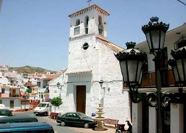
Almogía in Malaga


Almogía in Malaga
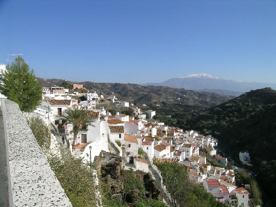
Almogía is a town and municipality in the province of Málaga, part of the autonomous community of Andalusia in southern Spain. The municipality is situated approximately 25 km from Malaga capital. It has a population of approximately 4,300 residents. What the natives are called Moriscos

Wednesday, April 1, 2009

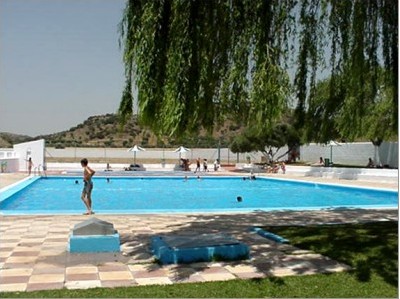
Almargen in Malaga


Almargen in Malaga
Almargen is a town and municipality in the province of Málaga, part of the autonomous community of Andalusia in southern Spain. The municipality is situated approximately 105 km from Malaga capital. It has a population of approximately 2,100 residents. The natives are called Almargeños.

Almáchar is a town In Malaga


Almáchar is a town In Malaga
Almáchar is a town and municipality in the province of Málaga, part of the autonomous community of Andalusia in southern Spain. The municipality is situated approximately 35 kilometres from Málaga capital. It has a population of approximately 2,100 residents. It is the capital of the moscatel raisin area. Natives of the area are called Almachareños. Basic data

Size: 14.30 km²

Population: 2,000

Residents known as: Almachareños

Monuments: Church of San Mateo.

Geographical situation: 35 km from Malaga and 14 from Vélez-Málaga, at 200 metres above sea level.

Tourist information: Town Hall, Plaza del Convento, 14. 29718. Phone: 952 512 002 Fax: 952 512 140.

Almáchar is situated in the heart of the Axarquía at 200 metres above sea level, 35 kilometres from Malaga city and 14 from Vélez-Málaga. It is built on a small hill between the El Borge and Almáchar rivers, close to the Mountains of Malaga and surrounded by vineyards, olive and cereal groves.

The municipality extends from the hill of the same name as the town (334 metres high) and the basin of the river Almáchar to the Vallejo peak, at 609 metres high. From the road one can see the typical country houses and areas where the grapes are hung out to dry (and thus become raisins), and the small terraced plots of land with orange and lemon trees growing. The first settlements in the area were made on the river bank, and were built in single or double storeys in rubble masonry, with roof tiles and an interior patio. The most interesting of the winding, narrow streets is calle Los Mártires, sights include the church that was built on the street itself, to maintain its level and a large restored 17th century door visible half way down the street. The church rests on a barrel vault that unites the church with the house in front. There are many interesting nooks and crannies in the town, like the Jardines de El Forte, the Barrio de las Cabras and the Plaza del Santo Cristo, where the interesting Museo de la Pasa is situated.

The name of the town derives from the Arabic "Al Maysar", meaning "The Meadows" or "Land of the Meadows", and used to form part of what was known as the "Four Villas", along with Cútar, El Borge and Moclinejo. They were under the protection of Comares, and following the re-conquest in 1487, their dependence on this town continued. The first real historical data we have on the place is from the 16th century, when a number of families involved in herding occupied the town after the Moriscos, angry about an agreement by which they used to cultivate fine grapes, had abandoned it. In 1611, Almáchar features in the Malaga Ordinances as Macharalyate. The placing of a huge cross on a nearby hill by the townspeople resulted in many writers referring to the place as Almáchar de la Cruz, a symbol which is still incorporated into the town¹s coat-of-arms. An earthquake in 1755 forced the people to leave their homes and take refuge in the countryside. The excellent quality of manufactured cloths from the town at the end of the 19th century made it known far and wide, and at this time there were more than a hundred workshops involved in this industry. One of the saddest periods in the history of Almáchar was during the Civil War years, when families were divided and friends pitted against friends as a result of differing political beliefs.
By : Wikipedia.com

Alhaurín de la Torre In Malaga


Alhaurín de la Torre In Malaga
Alhaurín de la Torre (pop 2006 30,281) is a town in Málaga province in Andalusia, Southern Spain. The town is part of Málaga Metropolitan Area, but traditionally belongs to the Guadalhorce Valley shire. It sits at the entrance to the Guadalhorce valley on the slopes of the Sierra de Mijas mountains, 10.5 miles (17 km) from Málaga city.
The origin of the place goes back to pre-historic times, and it is known that the Phoenicians that set up factories in Málaga and Cártama in about 1,000 B.C. settled in Alhuarín. It was here that Lauro was founded, and centuries later the Romans called it Lauro Vetus. The Moors, in their time, called it Albarracín, and it grew from that into a larger collection of farm-houses. The re-conquest of the town in 1485 meant another variation on the name, and the place was finally called Alhaurín de la Torre. The population increased sharply due to the influx of Christian settlers after 1571. There are many archaeological remains in the municipality, most of them being in the Estación de la Alquería area, officially designated as being of Cultural Interest.
By : Wikipedia.com